Dr Callum Munday, University of Oxford
Africa has contributed little to the increase of greenhouse gases, but the warming they cause will have profound effects across the continent. Potential changes in the incidence and intensity of droughts and floods are especially troublesome. Recent severe droughts in eastern and southern Africa, for example, offer a glimpse into one possible future of increasing stress on systems of food and energy production, and safe water supply.
The more credible information we have about possible future changes, the earlier effective planning and adaptation can begin. However, over Africa, information about climate change is difficult to come by. The climate models we use to look into the future tend to not perform well over Africa – or in other words, they do not agree with observations on the amount and distribution of present-day rainfall. There are also some large gaps in our knowledge of the regional climate.
In new research, published in Geophysical Research Letters, we address one important gap in our knowledge: how does water vapour move around the continent? We also consider whether climate models capture the major routes of water vapour transport. Water vapour is the key ingredient of rainfall and needs to be transported onto land from the oceans.
We find that water vapour transport is concentrated into a series of invisible rivers, which flow 500m above the ground surface in some of the major river valleys in eastern and southern Africa. Together, the atmospheric rivers transport five times the amount of water as the Congo River.
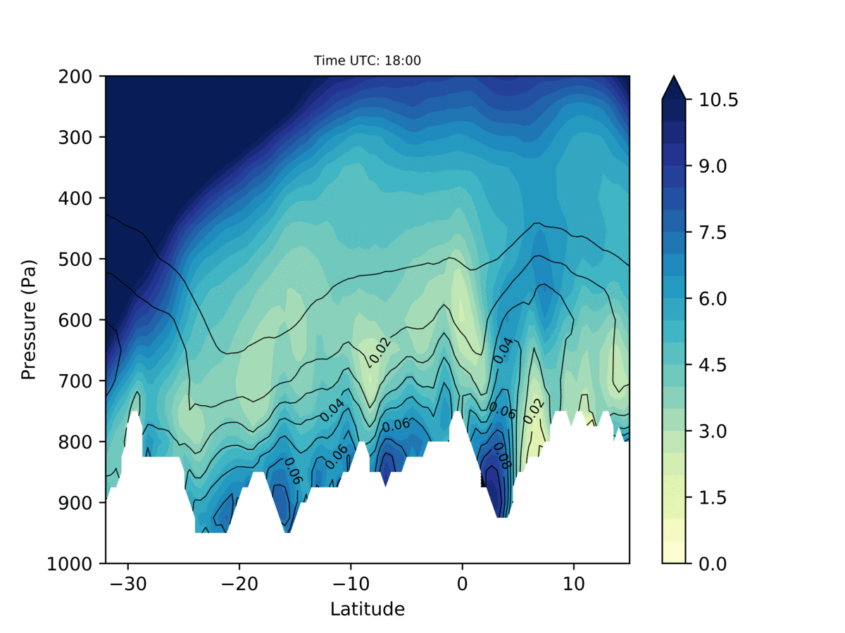
Figure 1: Cross section of water vapour (contours) and winds (shading) through the atmosphere across the East African Highlands. It shows how water vapour transport happens in the lower atmosphere through river valleys, and is strongest at night.
The invisible rivers flow east to west. In doing so, they transport water vapour, which originates in the Indian Ocean, through East Africa and eventually to the Congo Basin rainforest – one of the wettest places on Earth. Since the journey of water vapour takes it away from East Africa – the invisible rivers help to dry out the atmosphere and reduce rainfall in a number of East African countries including Kenya, Tanzania and Mozambique. When the transport is particularly strong, drought conditions prevail over much of East Africa: the invisible rivers are a key player in the aridity.
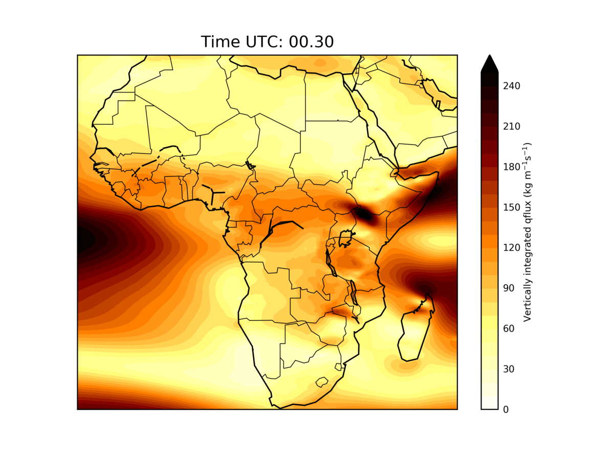
Figure 2: This animated map highlights the pulsing of water vapour transport over Africa through the day and night. It shows how water vapour moves mainly at night and sneaks inland from the Indian Ocean to the Congo Basin along major routes which correspond to river valleys.
Since the invisible rivers are important for droughts, it is important to know how well climate models simulate them. Promisingly, we find that the latest, cutting-edge models do well in capturing the atmospheric rivers. This is likely because they can represent the complex details of African river valleys and mountains.
Most models, however, – including those that contribute to the Intergovernmental Panel on Climate Change (IPCC) reports – aren’t able to represent the mountains very well and do not simulate the correct structures of the rivers. One consequence is that they then struggle to capture regional drought. We should be cautious about using those models to project future change.
While they are clearly important, we have very few observations of the invisible rivers: much of what we know comes from improving but imperfect model simulations. In future work, we will measure the invisible rivers in detail for the first time and, in doing so, lend insights into how they will change in the future. Hopefully, this will help policymakers prepare ahead of an uncertain future.
Reference:
Munday, C., Washington, R., & Hart, N. (2021). African low‐level jets and their importance for water vapor transport and rainfall. Geophysical Research Letters, 48, e2020GL090999. https://doi.org/10.1029/2020GL090999